Category:Castor, Cambridgeshire
Jump to navigation
Jump to search
village and civil parish in the City of Peterborough, England  | |||||
| Upload media | |||||
| Instance of | |||||
|---|---|---|---|---|---|
| Location | City of Peterborough, Cambridgeshire, East of England, England | ||||
| official website | |||||
 | |||||
Subcategories
This category has the following 7 subcategories, out of 7 total.
Media in category "Castor, Cambridgeshire"
The following 185 files are in this category, out of 185 total.
-
 'Durobrivae', The Green, Castor - geograph.org.uk - 5024625.jpg 1,280 × 876; 357 KB
-
 14 and 12 High Street, Castor - geograph.org.uk - 5024555.jpg 1,280 × 874; 337 KB
-
 33 Peterborough Road, Castor - geograph.org.uk - 5024666.jpg 1,280 × 853; 325 KB
-
 43 and 45 Peterborough Road, Castor (geograph 7319219).jpg 1,024 × 768; 181 KB
-
 43 and 45 Peterborough Road, Castor - geograph.org.uk - 5024646.jpg 1,280 × 853; 330 KB
-
 6a Peterborough Road, Castor (geograph 7319414).jpg 1,024 × 768; 215 KB
-
-
 A47 - Marholm Road bridge - geograph.org.uk - 3586161.jpg 640 × 480; 72 KB
-
 A47 at the junction for Castor - geograph.org.uk - 3586158.jpg 640 × 480; 63 KB
-
 A47 lay-by - geograph.org.uk - 5966444.jpg 640 × 444; 60 KB
-
 A47 lay-by near Castor - geograph.org.uk - 3586162.jpg 640 × 480; 61 KB
-
 A47 near Ferry House - geograph.org.uk - 3586157.jpg 640 × 480; 76 KB
-
 A47 towards Leicester - geograph.org.uk - 2645128.jpg 640 × 412; 62 KB
-
 A47 towards Peterborough - geograph.org.uk - 3020980.jpg 640 × 480; 86 KB
-
 A47 westbound - geograph.org.uk - 5966432.jpg 640 × 480; 68 KB
-
 A47 westbound - geograph.org.uk - 5966435.jpg 640 × 480; 55 KB
-
 A47 westbound - geograph.org.uk - 5966437.jpg 640 × 470; 51 KB
-
 A47 westbound - geograph.org.uk - 5966439.jpg 640 × 465; 58 KB
-
 A47, eastbound - geograph.org.uk - 4696728.jpg 640 × 426; 59 KB
-
 A47, westbound - geograph.org.uk - 4700756.jpg 640 × 376; 42 KB
-
 Ailsworth, The village sign - geograph.org.uk - 4501876.jpg 3,679 × 2,456; 6.78 MB
-
 Airstrip near Salter's Tree, aerial - geograph.org.uk - 3514585.jpg 640 × 427; 50 KB
-
 Barn - geograph.org.uk - 798905.jpg 640 × 480; 106 KB
-
 Barn at Hollies Farm, Castor - geograph.org.uk - 5015327.jpg 1,280 × 853; 323 KB
-
 Barn at Home Farm, Castor - geograph.org.uk - 5015309.jpg 1,280 × 866; 307 KB
-
 Barn by the Village Hall, Castor - geograph.org.uk - 5024648.jpg 1,280 × 853; 305 KB
-
 Base of the Farmers Cross, Castor (geograph 2446350).jpg 4,000 × 3,000; 4.11 MB
-
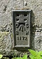
 Bench mark, 33 Peterborough Road, Castor - geograph.org.uk - 5024664.jpg 822 × 1,280; 467 KB
-
 Bridleway - geograph.org.uk - 2779618.jpg 4,320 × 3,240; 4.73 MB
-
 Bridleway and farmland northeast of Castor - geograph.org.uk - 67499.jpg 640 × 427; 107 KB
-
 Carved head, 33 Peterborough Road, Castor - geograph.org.uk - 5024670.jpg 1,280 × 853; 604 KB
-
 Castor House, Peterborough Road, Castor - geograph.org.uk - 5015314.jpg 1,280 × 853; 418 KB
-
 Castor Mills (geograph 7109946).jpg 3,776 × 2,520; 4.2 MB
-
 Castor Primary School - geograph.org.uk - 6159007.jpg 1,828 × 1,122; 1.15 MB
-
 Castor Road alongside Stamford Plantations - geograph.org.uk - 2446769.jpg 4,000 × 3,000; 4.07 MB
-
 Castor Road heading south - geograph.org.uk - 3020960.jpg 640 × 480; 102 KB
-
 Castor Road heading south - geograph.org.uk - 3020964.jpg 640 × 480; 114 KB
-
 Castor, Ferry Bridge - geograph.org.uk - 6241985.jpg 1,024 × 974; 438 KB
-
 Castor, Ferry Bridge - geograph.org.uk - 6241988.jpg 186 × 259; 43 KB
-
 Cattle Ford on the Back Dike - geograph.org.uk - 3019732.jpg 3,264 × 2,448; 3.04 MB
-
 Clay Lane Byway - geograph.org.uk - 794907.jpg 640 × 480; 142 KB
-
 Clay Lane Byway - geograph.org.uk - 794925.jpg 640 × 480; 101 KB
-

-
 Corner of a wheatfield - geograph.org.uk - 3084554.jpg 1,024 × 768; 141 KB
-
 Cottage on Stocks Hill (geograph 4021878).jpg 1,600 × 1,200; 582 KB
-
 Countryside south of Marholm, Peterborough - geograph.org.uk - 2516645.jpg 4,320 × 3,240; 5.62 MB
-
 Cycle track heading east by the A47 - geograph.org.uk - 3020993.jpg 640 × 480; 101 KB
-
-
 Daffodils on Love's Hill, Castor - geograph.org.uk - 4910094.jpg 800 × 547; 152 KB
-
 Eastern end of a large wheatfield - geograph.org.uk - 3084556.jpg 1,024 × 768; 132 KB
-
 Eastern side of Normangate Field - geograph.org.uk - 3084579.jpg 960 × 768; 123 KB
-
 Farm building off Marholm Road - geograph.org.uk - 3020975.jpg 640 × 480; 53 KB
-
 Farm building, New Park Farm - geograph.org.uk - 3021015.jpg 640 × 480; 56 KB
-
 Farm roadway near Milton Hall - geograph.org.uk - 2142304.jpg 2,848 × 2,136; 3.09 MB
-
 Farm track near Bushy Wood - geograph.org.uk - 2471259.jpg 640 × 480; 68 KB
-
 Farmland near Salters Wood - geograph.org.uk - 3020971.jpg 640 × 480; 77 KB
-
 Farmland near Stamford Lodge - geograph.org.uk - 3020962.jpg 640 × 480; 62 KB
-
 Farmland off Marholm Road - geograph.org.uk - 3020977.jpg 640 × 480; 75 KB
-
 Farmland off Mill Road - geograph.org.uk - 3020984.jpg 640 × 480; 88 KB
-
 Farmland towards Brakes Wood - geograph.org.uk - 3020504.jpg 640 × 480; 135 KB
-

-
 Farmland west of Splash Dike - geograph.org.uk - 3084575.jpg 1,024 × 768; 118 KB
-
 Farmland, New Park Farm - geograph.org.uk - 3021018.jpg 640 × 480; 87 KB
-
 Ferry Hill near Castor - geograph.org.uk - 4910083.jpg 800 × 480; 138 KB
-
 Field and hedge seen from Castor Road - geograph.org.uk - 2446787.jpg 4,000 × 3,000; 3.94 MB
-
 Field, south of Castor - geograph.org.uk - 6192122.jpg 1,024 × 776; 138 KB
-
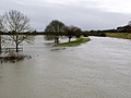
 Flooded water meadows (East Holmes) at Alwalton - geograph.org.uk - 3387186.jpg 1,280 × 960; 360 KB
-
 Floods at Ferry Meadows - geograph.org.uk - 3391681.jpg 1,280 × 960; 196 KB
-
 Footpath alongside a hedgerow - geograph.org.uk - 2446606.jpg 4,000 × 3,000; 4.22 MB
-
 Footpath through Normangate Field - geograph.org.uk - 3967077.jpg 800 × 600; 254 KB
-
 Footpath to Castor - geograph.org.uk - 3478873.jpg 2,000 × 1,500; 572 KB
-
 Footpath to Oldfield Pond - geograph.org.uk - 3020965.jpg 640 × 480; 101 KB
-
 Ford at Castor Mills - geograph.org.uk - 3019692.jpg 3,264 × 2,448; 3.79 MB
-
 Ford through back Dyke - geograph.org.uk - 1318954.jpg 640 × 480; 104 KB
-
-

-
 Former village shop, The Green Castor - geograph.org.uk - 5024617.jpg 1,280 × 887; 305 KB
-
 Fundamental Bench Mark - geograph.org.uk - 794931.jpg 640 × 480; 115 KB
-
 Gate on Castor Road south of Marholm, Peterborough - geograph.org.uk - 2142322.jpg 2,848 × 2,136; 2.96 MB
-
 Gnarled oaks along Helpston Road - geograph.org.uk - 2304334.jpg 1,280 × 960; 649 KB
-
 Grazing land, Bretton - geograph.org.uk - 3021303.jpg 640 × 480; 81 KB
-

-
 Hedgerow across fields near Castor - geograph.org.uk - 2446571.jpg 4,000 × 3,000; 4.32 MB
-
 Hedgerow near Castor - geograph.org.uk - 2446545.jpg 4,000 × 3,000; 4.11 MB
-
 High Street, Castor - geograph.org.uk - 5024601.jpg 1,280 × 853; 369 KB
-
 Home Farm, Castor - geograph.org.uk - 5015322.jpg 1,280 × 853; 384 KB
-
 House on Peterborough Road, Castor - geograph.org.uk - 6135024.jpg 1,920 × 1,280; 1.34 MB
-
 House on Stocks Hill, Castor - geograph.org.uk - 6134707.jpg 1,882 × 1,222; 1.01 MB
-
 Houses on Katharine Way, Bretton - geograph.org.uk - 3021011.jpg 640 × 480; 55 KB
-
 Houses on Samworth Close, Castor - geograph.org.uk - 6159008.jpg 1,920 × 1,280; 1.81 MB
-
 Junction On Clay Lane - geograph.org.uk - 794915.jpg 640 × 480; 130 KB
-
 Landy Green Way, Castor, Peterborough - geograph.org.uk - 2143701.jpg 2,848 × 2,136; 3 MB
-
 Lane towards Park Farm - geograph.org.uk - 3021017.jpg 640 × 480; 90 KB
-
 Limp Wind Sock - geograph.org.uk - 795070.jpg 640 × 480; 125 KB
-
 Looking along a hedgerow from Castor Road - geograph.org.uk - 2446593.jpg 4,000 × 3,000; 4.39 MB
-

-
 Love's Hill - geograph.org.uk - 2460897.jpg 640 × 480; 83 KB
-
 Love's Hill Bridge over the A47 - geograph.org.uk - 162333.jpg 640 × 480; 76 KB
-
 Love's Hill in Castor ^ Ailsworth - geograph.org.uk - 4910101.jpg 800 × 528; 123 KB
-
 Love's Hill towards Castor - geograph.org.uk - 3020982.jpg 640 × 480; 93 KB
-
 Marholm Road - geograph.org.uk - 2446588.jpg 4,000 × 3,000; 4 MB
-
 Marholm Road - geograph.org.uk - 2460901.jpg 640 × 480; 96 KB
-
 Marholm Road near Castor - geograph.org.uk - 2446581.jpg 4,000 × 3,000; 4.03 MB
-
 Marholm Road towards Castor - geograph.org.uk - 3020976.jpg 640 × 480; 100 KB
-
 Marholm Road towards Castor - geograph.org.uk - 3020978.jpg 640 × 480; 77 KB
-
 May Day steam - geograph.org.uk - 3967076.jpg 800 × 450; 332 KB
-
 Meadow near the Splash - geograph.org.uk - 3084572.jpg 1,024 × 768; 125 KB
-
 Milestone outside Castor House (geograph 5015318).jpg 1,280 × 1,280; 883 KB
-
 Mill Road heading south - geograph.org.uk - 3020983.jpg 640 × 480; 97 KB
-

-

-
 Nene railway bridge - geograph.org.uk - 4833037.jpg 1,600 × 1,200; 349 KB
-
-
 Nene Valley Railway crossing - geograph.org.uk - 2780258.jpg 4,277 × 3,208; 1.78 MB
-
 Nene Valley Railway heading to Peterborough - geograph.org.uk - 3880775.jpg 4,320 × 3,240; 5.96 MB
-
 New Trees - geograph.org.uk - 4021898.jpg 1,600 × 1,000; 759 KB
-
 Normangate Field - geograph.org.uk - 3084720.jpg 1,024 × 768; 120 KB
-

-
 Oil seed rape crop, ready for harvest - geograph.org.uk - 3084570.jpg 1,024 × 768; 111 KB
-
-
 Oilseed rape crop off Marholm Road - geograph.org.uk - 3020973.jpg 640 × 480; 61 KB
-
 Old Milestone - geograph.org.uk - 3252442.jpg 1,024 × 768; 280 KB
-
 Old Milestone - geograph.org.uk - 3252445.jpg 768 × 1,024; 279 KB
-
 Old Milestone by the former A47 in Castor (geograph 5622647).jpg 295 × 448; 101 KB
-
 Old windmill at Castor Mill - geograph.org.uk - 40939.jpg 640 × 481; 113 KB
-
 On the edge of Salter's Wood near Milton Hall - geograph.org.uk - 2516730.jpg 4,320 × 3,240; 5.86 MB
-
 Path through Salter's Wood in Milton Park - geograph.org.uk - 2516718.jpg 4,320 × 3,240; 5.82 MB
-
 Peterborough Road, Castor - geograph.org.uk - 6159006.jpg 1,888 × 1,232; 1.2 MB
-
 Pond in the middle of a wheatfield - geograph.org.uk - 3084559.jpg 1,024 × 768; 136 KB
-
 Public footpath near Salter's Tree - geograph.org.uk - 2460046.jpg 640 × 480; 81 KB
-
 Public footpath to Oldfield Pond - geograph.org.uk - 2460047.jpg 640 × 480; 89 KB
-
 Rape Field and Trees - geograph.org.uk - 4021894.jpg 1,600 × 1,000; 708 KB
-
 Redundant road near Castor, Peterborough - geograph.org.uk - 2142888.jpg 2,848 × 2,136; 3.03 MB
-
 Risky Stuff - geograph.org.uk - 794923.jpg 640 × 480; 101 KB
-
 River Nene - geograph.org.uk - 3866659.jpg 800 × 533; 97 KB
-
 River Nene - geograph.org.uk - 3866669.jpg 800 × 533; 101 KB
-
 River Nene - geograph.org.uk - 6192126.jpg 1,024 × 764; 104 KB
-
 River Nene and Hereward Way - geograph.org.uk - 3478912.jpg 2,000 × 1,500; 498 KB
-
 River Nene from Nene Valley Railway - geograph.org.uk - 3450600.jpg 2,000 × 1,500; 498 KB
-
 River Nene in flood - geograph.org.uk - 3391702.jpg 1,280 × 960; 160 KB
-
 River Nene in flood - geograph.org.uk - 3391706.jpg 1,280 × 960; 173 KB
-
 River Nene near Ferry Bridge - geograph.org.uk - 3020987.jpg 640 × 480; 98 KB
-
 River Nene near Ferry Meadows - geograph.org.uk - 5297922.jpg 5,184 × 3,456; 6.17 MB
-
-
 River Nene with horses grazing - geograph.org.uk - 2807301.jpg 640 × 427; 77 KB
-
 Road to Belsize Farm Marholm - geograph.org.uk - 2516630.jpg 4,320 × 3,240; 5.59 MB
-
 Roman masonry, Stocks Hill - geograph.org.uk - 5024554.jpg 1,280 × 853; 593 KB
-
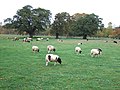
 Sheep in Milton Park near Peterborough - geograph.org.uk - 2142318.jpg 2,848 × 2,136; 3.07 MB
-
 Sheep near New Park Farm, Bretton, Peterborough - geograph.org.uk - 2142541.jpg 2,848 × 2,136; 3.13 MB
-
 Signpost at end of Cow Lane - geograph.org.uk - 4021889.jpg 1,600 × 1,200; 900 KB
-
 Splash Dike - geograph.org.uk - 3450642.jpg 2,000 × 2,000; 614 KB
-
 Sports Pavilion at Castor - geograph.org.uk - 1319045.jpg 640 × 480; 80 KB
-
 Stamford Lodge - Milton Park - geograph.org.uk - 162343.jpg 640 × 480; 78 KB
-
 Stamford Plantation - geograph.org.uk - 2460052.jpg 640 × 480; 112 KB
-
 Stocks Hill, Castor - geograph.org.uk - 5016220.jpg 1,280 × 853; 379 KB
-
 Stocks Hill, Castor - geograph.org.uk - 5016222.jpg 1,280 × 851; 492 KB
-
-
 The Cedars, Castor - geograph.org.uk - 5017142.jpg 1,280 × 867; 424 KB
-
 The end of their walk - geograph.org.uk - 3391696.jpg 1,280 × 960; 382 KB
-
 The Farmers Cross at Castor (geograph 2446359).jpg 3,000 × 4,000; 4.28 MB
-

-
 The Green and Farmers Cross at Castor (geograph 2446365).jpg 4,000 × 3,000; 4.45 MB
-
 The Hollies Farmhouse, Castor - geograph.org.uk - 5015324.jpg 1,280 × 853; 312 KB
-
 The Nene Valley Railway - geograph.org.uk - 2446392.jpg 4,000 × 3,000; 4.35 MB
-
 The Old Chapel, Church Hill, Castor - geograph.org.uk - 5024616.jpg 1,280 × 895; 306 KB
-
 The Old Rectory, Castor - geograph.org.uk - 5024537.jpg 1,280 × 854; 550 KB
-
 The Old Smithy, Peterborough Road, Castor - geograph.org.uk - 5024641.jpg 1,118 × 1,280; 666 KB
-
 The remains of Castor Windmill - geograph.org.uk - 2446516.jpg 4,000 × 3,000; 3.96 MB
-
 The River Nene looking towards Castor Windmill - geograph.org.uk - 2446533.jpg 4,000 × 3,000; 4.04 MB
-
 The River Nene looking towards Castor Windmill and Watermill - geograph.org.uk - 2446525.jpg 4,000 × 3,000; 4.23 MB
-
 The River Nene, looking downstream - geograph.org.uk - 3084549.jpg 1,024 × 768; 104 KB
-
 The Village Hall, Castor (geograph 7319222).jpg 1,024 × 771; 172 KB
-
 Track by Salters Wood - geograph.org.uk - 3020968.jpg 640 × 480; 114 KB
-
 Track near New Park Farm, Bretton, Peterborough - geograph.org.uk - 2142537.jpg 2,848 × 2,136; 2.99 MB
-
 Trees by Helpston Road - geograph.org.uk - 6140337.jpg 1,872 × 1,204; 1.66 MB
-
 Trees In Oil Seed Rape - geograph.org.uk - 795077.jpg 640 × 480; 107 KB
-
 Trees on Castor Road near Milton Park - geograph.org.uk - 2142670.jpg 2,848 × 2,136; 3.14 MB
-
 UK Castor.jpg 832 × 1,675; 298 KB
-
 View of Nene Valley meadows from Mill Road, Castor - geograph.org.uk - 2446406.jpg 4,000 × 3,000; 3.97 MB
-
 Village Hall, Castor - geograph.org.uk - 5024651.jpg 1,280 × 853; 313 KB
-
 Vine House, Church Hill, Castor - geograph.org.uk - 5024608.jpg 1,280 × 1,280; 598 KB
-
 Warning - Paths flooded - geograph.org.uk - 3391687.jpg 1,280 × 960; 355 KB
-
 Watermill on the River Nene - geograph.org.uk - 2446492.jpg 4,000 × 3,000; 4.27 MB
-
 Western end of a large wheatfield - geograph.org.uk - 3084563.jpg 1,024 × 768; 140 KB
-
 Woodland by Love's Hill, Castor - geograph.org.uk - 6187156.jpg 1,872 × 1,204; 1.8 MB


.jpg)

.jpg)


.jpg)


.jpg)


.jpg)


_at_Alwalton_-_geograph.org.uk_-_3387186.jpg)


.jpg)


.jpg)


.jpg)

.jpg)


.jpg)


